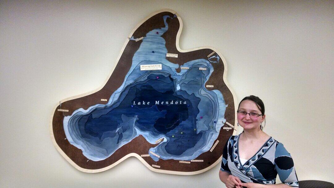
The result is this three-dimensional installation with a magnetic surface, allowing anyone to change the features on the map. Labels can be added to show important features or completely stripped off for a more minimalist presentation.
Just after the map was installed on the wall:
Here's an example of the map with labels added:
 |
Further reading about this project:
| WOW! I was surprised and excited to be featured on Make magazine's website in this post posted June 16, 2014 |
| This wonderful blog post about the finished product from the Wisconsin Union newsletter, Terrace Views posted June 16, 2014 |
| This blog post from UW Communications and the UW-Madison Geography Department news posted June 24, 2014 |
| My blog post about the completed project and the design choices that shaped it, posted to the University of Wisconsin Cartography Lab blog. posted May 27, 2014 |

|
My blog post about the process of building the map, also posted to the UW Cartography Lab blog. posted May 19, 2014 |

|
This blog post from the Wisconsin Union, which describes the project at an early stage in the building process. It includes several photos of our initial work with the CNC router, cutting the map pieces out of stock material.
posted Dec 2, 2013 |

|
This blog post by fellow Geography Department alum Melanie McCalmont, who wrote a book about the relief maps in Science Hall!
posted Nov 25, 2016 |


No comments:
Post a Comment